|
A presentation to the Rochester Philatelic Association
Neither snow, nor rain, nor... Have you ever thought of the many ways the weather has been depicted on or influenced philatelic material of all kinds? The US Postal Service this year decided to issue a sheetlet of 15 stamps showing different types of clouds in honor of Stamp Collecting Month. This brief presentation will show you some familiar and unfamiliar items which hopefully will lead you to a better appreciation for "weather and philately." The Plan for this Presentation Introduction
Meteorological Variables and Instruments Scientists and Inventors
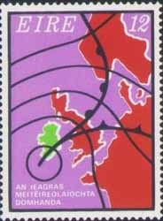
Weather Organizations Clouds Weather Disaster Philatelic Tributes Introduction
Meteorological Variables and Instruments Scientists employ a variety of instruments to measure current conditions and predict what's on the way. This section depicts many of them!
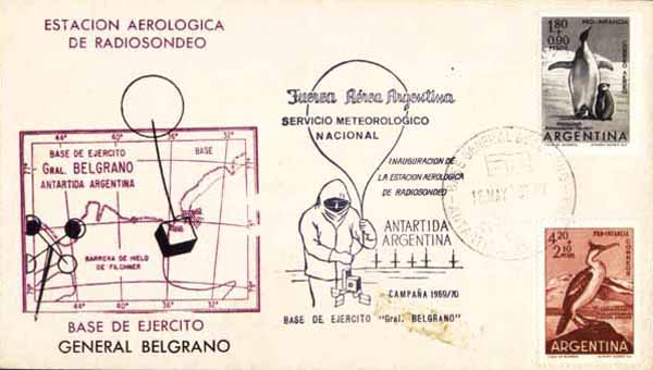
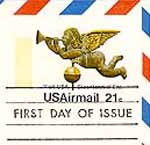
1969 Argentinian Antactic base cover Wind Direction
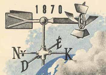
Weathervanes are decorative items made of cast iron, copper, and other materials. Also known as weathercocks, the central figure spins on a vertical rod, pointing in the direction of the wind. The first may date back to 48 BC, found on top the Tower of the Winds in Athens showing the god Triton. ********************
Windsock- a truncated cloth cone mounted on a mast; used to show the direction of the wind. Commonplace at airports especially during both World Wars, these windcatchers were quick visual aids before the days of electronics. Wind Speed
An anemometer measures wind speed. They come in a variety of types. Most recognizable are the "rotational vane" kind with three or four cups, invented in 1850. It works on the principle that the rotational speed of the cup turbine is proportional to the wind speed.
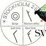
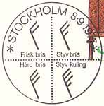
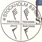
Like isobars, wind results can be plotted to get a macro view of gusts. "Wind barb" symbols represent various knot speeds. The barbs point in the direction the wind is coming from. 1 knot = 1.15 miles per hour Air Pressure
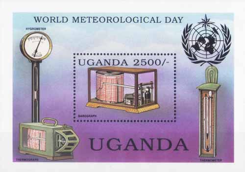
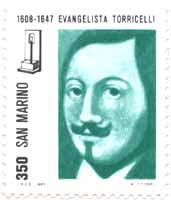
Barometers, from the Greek word meaning measure of weight or pressure, were first invented in 1648. Increases or decreases in atmospheric pressure predict weather changes are ahead in the next 24-48 hours. A barograph uses paper to record pressure changes. ********************
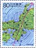
Isobars are features drawn on maps which connect areas of equal pressure. The closer the lines, the more intense the winds, especially during storms and hurricanes. Temperature
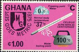
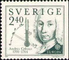
Everyone is familiar with thermometers, from medicine, to food, to refrigerators. Most are the liquid in glass type. They typically use mercury or red colored alcohol which expands and contracts through the bore within a sealed glass tube. Temperatures, like wind speed and air pressure, can be plotted. Humidity
Leonardo DaVinci developed the first basic hygrometer in 15th century, measuring relative humidity in the air. Modern hygrometers measure resistance changes of a semiconducive material to determine humidity levels. Dry and wet bulb thermometers can also be used in tandem to calculate humidity. Precipitation
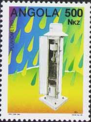
Koreans claim to have made the first rain gauge in 1441. It was a small bucket put atop a stone slab. Water would fall into it and be measured regularly with a graduated stick. The process is much more automated today, but the principle is the same. Devices are technically called pluviometers. Cloud cover
Radar sends out a beam of radio waves, then measures the intensity of what is reflected back. The reflection can be affected by rain, hail, snow, and other factors. Doppler radar is more complex, and can also determine wind speed and direction by measuring changes in the frequency of the reflected beam. Solar radiation
Radiation from the sun scatters around the atmosphere and is reflected from the Earth. Just how intense is it? An actinometer can tell. Combined Functions
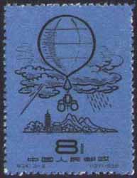
A radiosonde is an instrument package lifted by a balloon to heights of 30 km measuring temperature, humidity and
pressure. Reports are transmitted back to Earth by radio. Its name comes from a combination of the words "radio" (for
the transmitter) and "sonde" ("messenger" from old English). They were first used by the U.S. Weather Bureau in 1936.
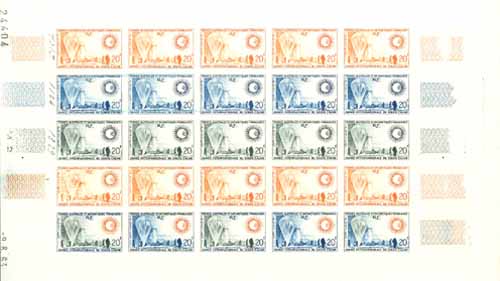
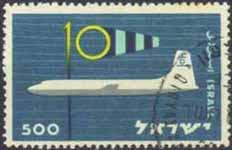
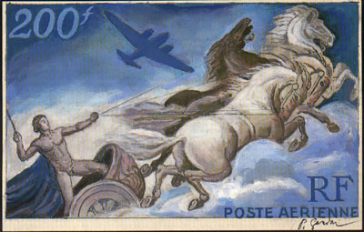
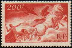
1966 French Southern and Antarctic Territory color trial complete sheet
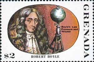
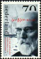
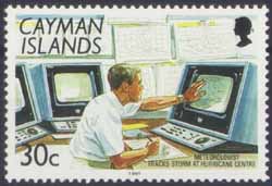
Modern electronics enable weather ships, planes and satellites to collect data which feeds into the most powerful supercomputers and weather modeling software in the world, predicting short-term and long-term forecasts. All these tools are especially invaluable when tracking hurricanes. Scientists and Inventors Here is a brief look at some of the people whose discoveries or inventions have played an important role in weather and meteorological history.
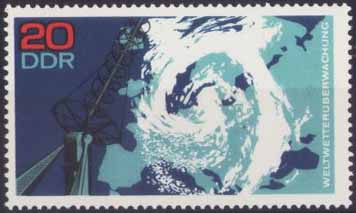
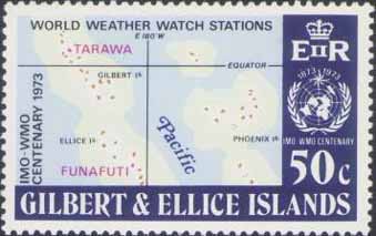
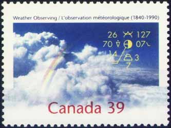
Weather Organizations There are a myriad of national through international organizations which deal with the weather. Here are just a few. U.S.
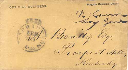
Early on the role of weather forecasting and reporting was in the hands of the U.S. military. This cover postmarked with a "free" Washington, DC postmark dates to 1852 and is from the Surgeon General's office. It contained a circular and a correction sheet to the Meteorological Register for July, August, and September, 1852. ********************
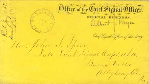
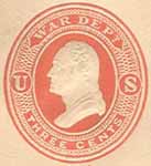
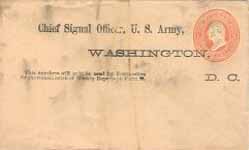
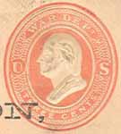
The U.S. War Department's Signal Service was the organization coordinating weather activity. This cover bears the free frank of the Chief Signal Officer of the Army, Albert J. Myer, on an official business cover. It was mailed January 14, 1868 from Washington and bears a different "free" postmark. On July 1, 1873 Congress abolished franking priviledges of government officials, like the one above. Stamps and postal stationery was ordered prepared by the Postmaster General for each department, including the War Department. ********************
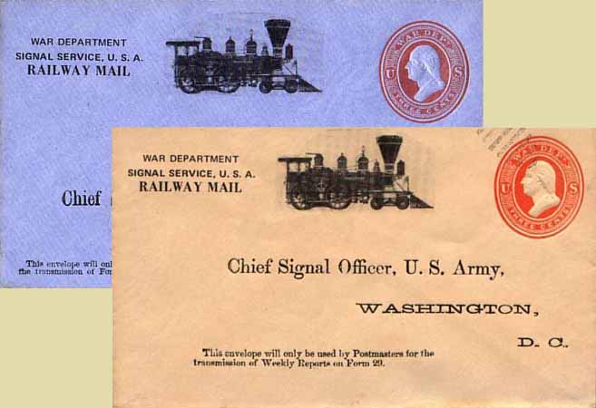
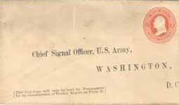
Volunteer weather reporters were recruited by the Signal Service in 1870 when Congress charged the organization with collecting statistics from around the country. The envelopes here were used to send weekly "Form 29" reports back to headquarters in Washington, DC. At least 5 different type face settings are known.
Here are two more type face settings, both with their address printings misplaced. ********************
Wrappers were also used, as in this 1 cent example printed sometime after June 18, 1881, per the inscription. By July 5, 1884 department envelopes became obsolete and each organization was allowed to use a design of their own without a denomination indicating that it was official mail.
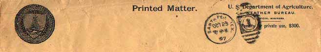
On July 1, 1891 the weather program became the responsibility of the newly created Weather
Bureau of the Department of Agriculture. Preprinted envelopes were no longer used to
send reports. Above is the cropped portion of a large report envelope used on October 29,
1897 from Santa Fe, New Mexico. New Mexico gained statehood in 1912.
********************
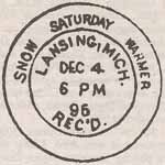
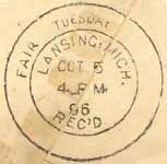
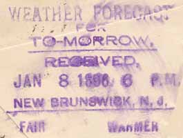
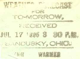
In 1895 the U.S. Post Office Department began an experiment using special backstamps on incoming mail for that day's delivery, primarily in rural areas to tell farmers the upcoming forecast. Two cancel styles were used: a round double ring type, and a linear type.
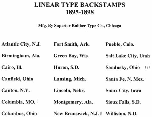
The linear type cancel was manufactured by the Superior Rubber Type Company of Chicago, which created the cancels for 21 communities around the country. They were in use until 1898. ********************
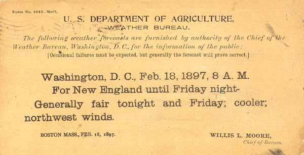
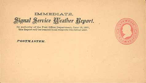
This is the reverse of a postcard mailed from Boston's weather bureau on February 18, 1897 with New England's forecast. These cards were mailed free with the penalty message stating in the return address: "By authority of the Post Office Department, June 18, 1881, this Report will be treated in all respects as letter mail." Note "Occasional failures must be expected...". ********************
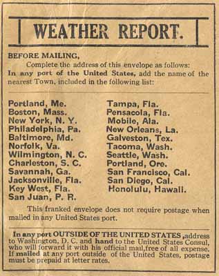
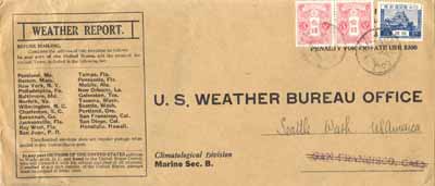
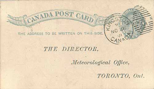
This is a weather report envelope from the Climatological Division - Marine Sec. B. The penalty cover was preprinted to the U.S. Weather Bureau Office, with SAN FRANCISCO, CAL. stamped as the city of destination, later crossed out with Seattle written in. Contrary to the instructions, it was not handed to a U.S. Consulate officer outside of the mails. Canada
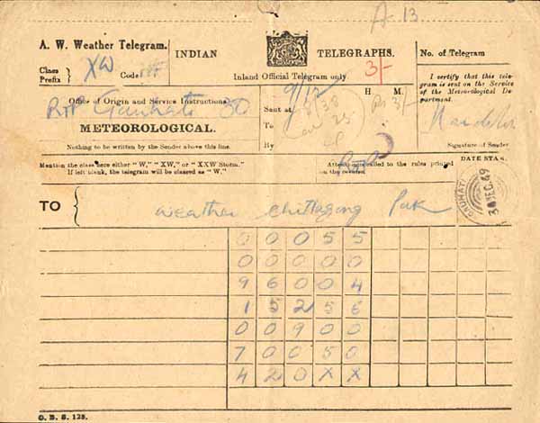
India
Here is an example of a weather telegram from India, postmarked December 30, 1949. The numbers could represent rainfall or temperature readings. Multi-National
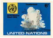
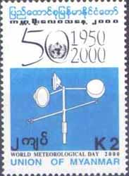
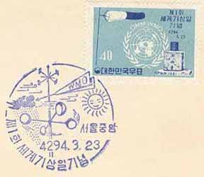
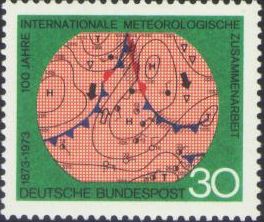
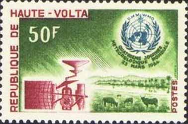
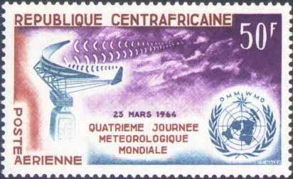
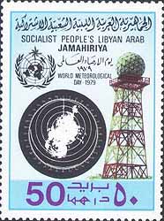
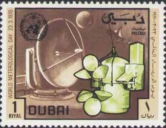
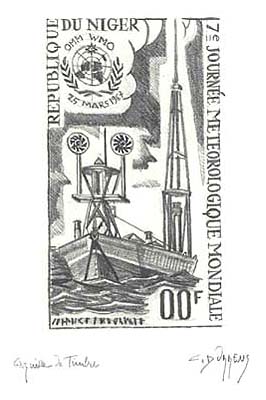
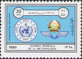
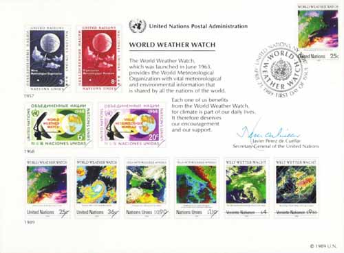
With 187 member states, the WMO deals with meteorology and the geophysical sciences. It was
formerly the International Meteorological Association, founded in 1873, and now is under the
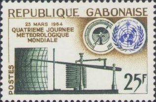
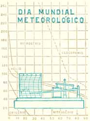
auspicies of the United Nations. They annually sponsor World Meteorological Day on March 23.
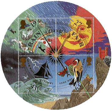
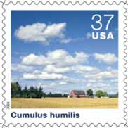
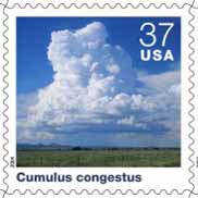
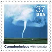
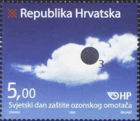
Clouds
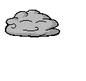
Clouds have an almost mythological and etherial quality about them. Are they indeed the place where gods dwell? Cloud Classifications
Fair skies or stormy, just look up and you can see a variety of cloud types. ********************
********************
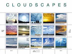
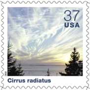
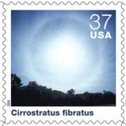
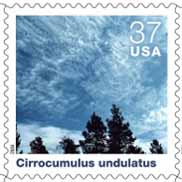
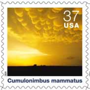
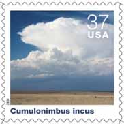
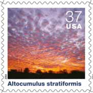
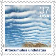
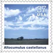
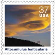
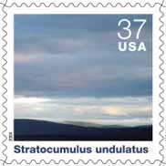
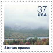
The following information is from the official USPS worksheet on the Cloudscape issue. October 4, 2004 first day national release, official city- Milton, MA. (Information printed on the on the back of the stamp pane outside of the stamp area.) "Clouds develop when moist air cools to its dew point by rising to a higher altitude or by moving over a cooler surface. Water vapor in the air then condenses in liquid or frozen form around minute particles such as pollen or dust. The shapes and altitudes of clouds, as well as the sequences in which they develop, help people forecast the weather. "In the early 19th century, Englishman Luke Howard chemist by trade and meteorologist by avocation created a system for classifying clouds using Latin names. He described the three most common shapes as cirrus (curl of hair), stratus (layer), and cumulus (heap); he also defined four compound cloud forms that derive from the three primary shapes, including nimbus (rain). Later scientists added terms such as humilis (small) and incus (anvil) to designate other cloud properties. The International Cloud-Atlas, first published in 1896, is based on this classification system. "Nine of the ten basic cloud genera are pictured on this stamp pane and arranged according to altitude. The prefixes "cirro" and "alto" distinguish high- and middle-altitude clouds, respectively. Nimbostratus, a dark, featureless cloud, is marked by falling rain or snow. As the Nimbostratus lacks defined shape, a reproduction of its image through a stamp would appear to be meaningless visually."
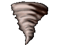
Weather Disaster Philatelic Tributes Natural disasters of all kinds have led to the creation of semipostal stamps and other philatelic items to finance relief funds. Here are a few examples. Floods
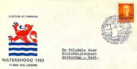
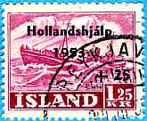
Europe and the Netherlands suffered a great flood on January 31, 1953 from a combined high tide and
storm. Levies broke, resulting in 1,835 deaths. Semipostals were issued in several countries
with the surcharge going to relief for the survisors.
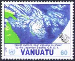
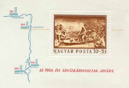
The Danube River has overflowed several times. After a devestating flood in 1965, Hungary issued this souvenir sheet showing a rescue scene from a previous flooding in 1838. Hurricanes and Cyclones Hurricanes, typhoons and cyclones are regional names all referring to the same weather phenomenon. These low pressure fronts with circular convection are seen most frequently in the tropic and sub-tropic regions. ********************
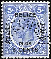
Overprinting regular stamps is the quickest and most frequent technique postal administrations use to create semipostals. The 1935 British Honduras stamp here is a perfined specimen. ********************
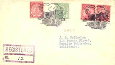
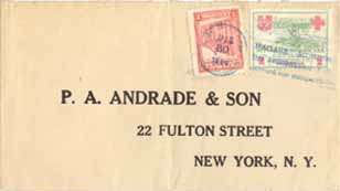
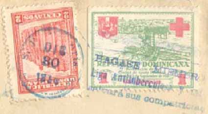
The Dominican Republic had a terrible 150 mph hurricane ravage the country in 1930. Between
4,000 and 8,000 people died. Above is a first day of use cover dated December 30 using a 1
cent postal tax stamp depicting the capital, Santo Domingo. Its use was mandatory on all
letters to help defray cleanup costs. The stamps came in 1, 2, 5, and 10 cent denominations.
Volcanic Eruptions
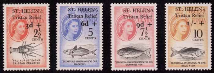
While not a weather phenomenon, volcanic eruptions do cause great havock through brief climatic changes. This classic set commemorates the 1961 evacuation of Tristan da Cunha residents to St. Helena after the volcano there erupted. The overprinting had not been approved by the Colonial Office in London. The stamps were withdrawn after being on sale for only seven days with 434 sets being sold. General Resources
WebNet.com - The Meteorological Resource Center
NOAA - National Oceanographic and Atmospheric Administration
I am indebted to Don Hillger and Garry Toth who maintained their "Weather Philately" website
where many of the images and technical basics originated.
Also thanks to Joe Crosby for his assistance
in providing some of the Signal Corps covers and all of the 1895 weather backstamp material.
© Webmaster Tom Fortunato |